GIS & Suitability Analysis
Wetland Restoration Suitability Analysis
Washington and Ozaukee Counties, Wisconsin
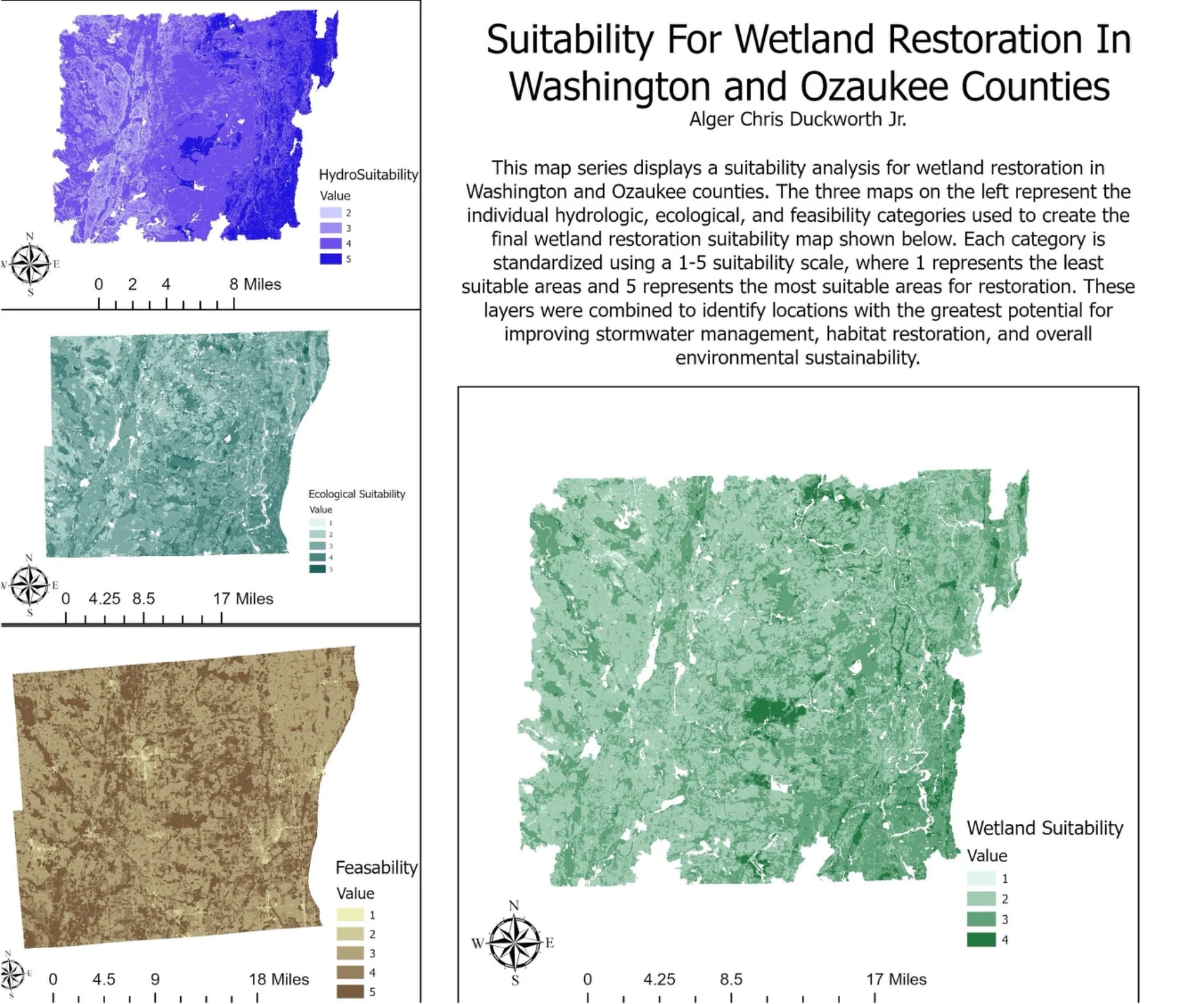
This project utilized Geographic Information Systems (GIS) and multi-criteria spatial analysis to identify priority areas for native wetland restoration throughout Washington and Ozaukee Counties. The primary objective was to evaluate where wetland restoration could provide the greatest benefits for stormwater management, flood mitigation, habitat restoration, and overall environmental sustainability.
The analysis incorporated a variety of environmental datasets including hydrology, stream networks, topography, soils, land cover, impervious surface coverage, and ecological connectivity. These datasets were standardized and combined using a weighted suitability model to assess restoration potential across the landscape. Separate hydrologic, ecological, and feasibility analyses were developed before being integrated into a final suitability model that identified areas where restoration efforts would be both environmentally beneficial and practically achievable.
The resulting map series provides a decision-support framework that can be used by planners, conservation organizations, municipalities, and landowners to prioritize restoration investments and improve watershed resilience. By identifying locations where natural water storage and habitat restoration opportunities overlap, this project demonstrates how GIS can support sustainable land management and long-term flood reduction strategies.
Project Components
Hydrologic suitability analysis
Ecological suitability analysis
Restoration feasibility assessment
Watershed and wetland connectivity evaluation
Multi-criteria weighted overlay modeling
Stormwater and flood mitigation planning